
Why Drone Surveying Matters on Modern Projects
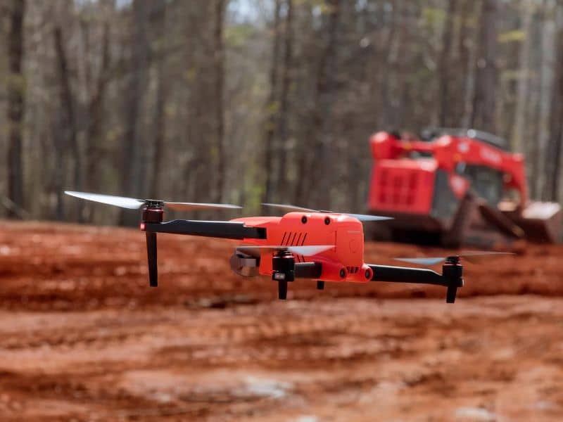
Walking a 40-acre site with a GPS rod can take a crew several days. A survey drone can fly the same ground in an afternoon and capture millions of data points along the way. That speed changes how quickly a project can move from idea to design to dirt work.
Drone surveying gives developers, engineers, and contractors a detailed picture of a site at each stage of a project. It works best when it’s planned with clear accuracy goals and tied to ground control by a licensed surveyor. Used that way, it cuts guesswork, saves field time, and keeps everyone working from the same data.
How Drone Surveying Captures Detailed Site Conditions Before Project Design
Before design starts, the team needs to know what’s on the ground. A survey drone flies a set pattern and takes hundreds or thousands of overlapping photos. Software stitches those images into a single map and builds a 3D model of the surface.
From that model, the surveyor can produce several useful products:
- An orthomosaic, which is a scaled aerial photo you can measure on
- A surface model showing ground elevations
- Contour lines for grading and drainage design
- Locations of visible features like curbs, buildings, and pavement edges
This data gives designers a strong starting point. They can see existing slopes, drainage paths, and site features without waiting weeks for a full ground survey. Some items still need field work, such as underground utilities, property corners, and areas hidden under trees or structures.
Aerial Mapping Data for Coordinating Engineers, Architects, and Contractors
Projects run into trouble when each team works from a different set of drawings. Aerial mapping gives everyone one shared view of the site. The civil engineer, architect, and contractor can all check the same image and elevations.
That shared base helps catch conflicts early. An architect can see how a building footprint sits against existing grades. A contractor can plan haul roads, laydown areas, and staging before mobilizing equipment.
Drone data also helps with meetings and approvals. A clear aerial image makes it easier to explain a plan to owners, lenders, or local reviewers. People understand a site faster when they can see it from above.
Monitoring Construction Progress Through Repeat Drone Survey Flights
A single flight shows the site at one moment. Repeat flights show how it changes over time. Many teams schedule flights weekly, monthly, or at key milestones like mass grading or foundation pours.
Each flight creates a dated record of site conditions. Owners can compare progress against the schedule without walking every corner of the job. Project managers can spot delays, out-of-place stockpiles, or drainage problems before they grow.
These records can also help settle questions later. If there’s a dispute about when work was done or what conditions looked like, the aerial images provide a clear history. Store each flight’s data with its date and project phase so it’s easy to find.
Drone Surveying for Measuring Earthwork Volumes and Material Stockpiles
Earthwork is one of the biggest costs on many projects. Contractors need to know how much dirt has been moved, how much remains, and how much material sits in each pile. Drone surveys measure those volumes by comparing surfaces.
The process is fairly simple. The surveyor compares a current surface to an earlier one or to the design grade. The difference between the two gives cut and fill quantities for the area flown.
Stockpile measurement works the same way. A drone can fly over gravel, topsoil, or fill piles and calculate their volume in a short visit. That’s safer than sending a crew to climb the piles, and it’s useful for checking deliveries and payments.
Accuracy Requirements and Ground Control in Professional Drone Surveys
Not all drone maps are survey grade. A nice-looking aerial photo can still be off by several feet if it isn’t tied to known points on the ground. Professional drone surveying uses ground control to bring the data into line with real coordinates.
Ground control points are marked targets set on the site and measured with survey-grade GPS or a total station. The software uses them to adjust the model so it fits the real world. Check points, which are measured but not used in the adjustment, help test the final accuracy.
Accuracy needs depend on the purpose. A progress image may not need tight accuracy, while a design surface or volume report often does. Talk with your surveyor about the accuracy your project needs, and ask how it will be checked and reported.
Licensing and Airspace
Commercial drone pilots in the United States need FAA certification to fly for business purposes. Some sites also sit in controlled airspace that requires added approval before a flight. These steps can affect scheduling, so plan flights early on time-sensitive projects.
Frequently Asked Questions
How Does Drone Surveying Improve Planning for Modern Construction Projects?
Drone surveying captures site conditions quickly and gives designers detailed maps and surface models. That early data helps engineers plan grading, drainage, and building placement with fewer surprises. Everyone on the team can work from the same aerial base. Faster data often means design can start sooner.
What Types of Site Data Can Professional Survey Drones Collect?
Survey drones can produce aerial maps, surface models, contours, and 3D point clouds. They can also capture visible features like pavement, curbs, structures, and stockpiles. Some drones carry LiDAR sensors that can measure ground under light vegetation. Underground utilities and property corners still require field methods.
Can Drone Surveying Help Track Construction Progress and Earthwork Changes?
Yes, repeat flights are one of the most common uses on active job sites. Each flight creates a dated record of the work completed. Comparing surfaces between flights shows how much earth has moved. Contractors use those numbers for scheduling, billing, and planning.
How Accurate Is Drone Surveying Compared With Traditional Ground Surveys?
With good ground control and proper processing, drone surveys can reach accuracy suitable for many design and volume tasks. Ground surveys with GPS or a total station are still more precise for single points like corners or pipe inverts. Accuracy also depends on flight height, camera quality, and site conditions. Ask your surveyor what accuracy to expect and how it will be verified.
When Is Ground Control Necessary for Drone Surveying Projects?
Ground control is needed any time the data will be used for design, quantities, or measured decisions. It ties the drone data to real coordinates and elevations. Some newer drones use onboard GPS correction that can reduce the number of control points needed. Most professional surveyors still use check points to confirm the results.