
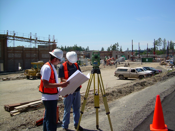
Purpose of Construction Surveys
Before construction activities are started, thorough planning and design is carried out. Before and throughout the construction period a surveyor assists in the work progress as necessary. As expected the construction surveyor guides the placement of the constructed items by providing points to the constractor that can be used to place them in the proper location. Thus construction staking is an important piece to the whole construction project.
So, what is Construction Surveying?
 The following is a brief introduction of what a construction survey is. It is important that contractors building a project should understand at least what it is and its significance to these designed projects.
A Construction Survey is basically a survey that presents locations and marks for construction activities; the process of executing, evaluation, and estimation prior to or during construction activities. It is also known as construction layout, or construction staking. Measurements are done for reference points which determine the location of the planned structure or improvements, vertical and horizontal positioning, dimensions, configuration, and to control the elevation of the new structures.
Purpose of A Construction Survey
The purpose of doing a construction survey is to maintain and establish the necessary vertical and horizontal control points needed for the proper location of the construction items to be built. This survey may also provide measurements which are needed determine quantities as documentation to corroborate the final payments made to the contractor.
Post construction, the survey is used to assess the final position and adequacy of the work, and to compute construction payments and be able to establish “as built” conditions. The “As Built” construction survey is conducted as the construction work is finished to verify the position as specified on the designs and plans.
Tasks Involved in a Construction Survey
Research, Reconnaissance, Control, and Mapping of the project area respectively are the tasks in this phase of an engineering project. Thisis a preliminary survey which is mainly the collection of data and establishing the survey control scheme that will be used during construction to “control” the position and elevation of each improvement. The result of this work is used for design, detailing of plans, and estimation of the project costs.
Gathering of the Design Data which include Project plans in digital and hard copies, Control Data (Vertical and Horizontal), Alignments (Vertical and Horizontal), New Roadway DTM, R/W data (with maps, descriptions and obligations), and Specifications.
Field Work includes Recovery of existing vertical and horizontal control, Augmentation and replacement of control stations that are necessary to control the construction project, Performing random checks of the vertical and horizontal control network, Checking Vertical controls as necessary, comparison of resultant coordinates to the original, collection of confidence points to check and validate the terrain model, condition documentation, and performing utility relocation surveys as necessary.
 Finally, here is an illustrated example of how a complete Construction Survey looks. The final piece that is presented after the tedious measurements and markings is an as-built topographic survey map which includes all of the vital features illustrated with the contours that represents the elevations. Some projects require these to be done to ALTA survey standards.